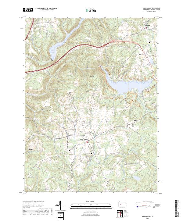
2023 Map of Brush Valley
USGS Topo · Published 2023About this map
Chestnut Ridge dominates the northern landscape of this Indiana County region, where the steep terrain drops toward the Two Lick Creek Reservoir and the winding course of Yellow Creek. This area is characterized by a dense network of small family and community burial grounds, reflecting the deep-rooted settlement history of places like Brush Valley and Penn Run. The map records several legacy sites, including the Brush Valley Methodist Cem and the Dutch Bethel Evangelical Cem, which serve as vital touchpoints for local genealogy.
Find a feature on this map
89 named features on this map. Tap any name to fly to it.
Don’t see what you’re looking for? This feature index may not catch every label — zoom into the map to look around manually.
Map Details
Editions of this 2023 Brush Valley Map
This is the sole edition of this map. No revisions or reprints were ever made.
Other maps of this area

1902 · Indiana
USGS Topo · 1:62,500

1902 · Barnesboro
USGS Topo · 1:62,500

1904 · Barnesboro
USGS Topo · 1:62,500

1904 · Johnstown
USGS Topo · 1:62,500

1907 · Johnstown
USGS Topo · 1:62,500

1920 · New Florence
USGS Topo · 1:62,500

1921 · New Florence
USGS Topo · 1:48,000

1922 · New Florence
USGS Topo · 1:62,500

1943 · Punxsutawney
USGS Topo · 1:125,000

1944 · New Florence
USGS Topo · 1:62,500
Featured Places
- Brush Valley Township, PA
- Cherryhill Township, PA
- Buffington Township, PA
- Center Township, PA
- White Township, PA