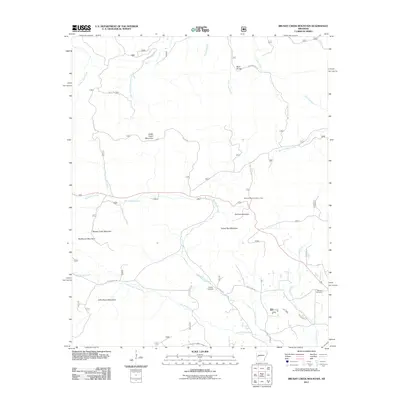
2011 Map of Brushy Creek Mountain
USGS Topo · Published 2011About this map
Cedar Cabin Mountain and Brushy Creek Mountain dominate this Ouachita National Forest landscape in western Arkansas. The terrain is defined by a series of steep ridges and creek drainages, including the headwaters of Big Brushy Creek and Little Brushy Creek. This 2011 survey documents the established network of forest service and county roads, such as Nat For Dev Rd 33 and Whitetown Rd, which provide access to secluded family landmarks and recreation spots. Genealogy researchers will find interest in the Brushy Cemetery and Grenade Cemetery, both located in the southern portion of the quadrangle. The map also highlights the Blowout Mountain Scenic Area near Salmon Mountain, illustrating the preservation of local vistas alongside the winding paths of Sweetwater Creek and Polk Creek.
Find a feature on this map
31 named features on this map. Tap any name to fly to it.
Don’t see what you’re looking for? This feature index may not catch every label — zoom into the map to look around manually.
Map Details
Editions of this 2011 Brushy Creek Mountain Map
This is the sole edition of this map. No revisions or reprints were ever made.
Other maps of this area

1887 · Mount Ida #2
USGS Topo · 1:62,500

1890 · Mount Ida
USGS Topo · 1:125,000

1955 · Little Rock
USGS Topo · 1:250,000

1956 · Little Rock
USGS Topo · 1:250,000

1959 · Oden
USGS Topo · 1:62,500

1959 · Mount Ida
USGS Topo · 1:62,500

1960 · Little Rock
USGS Topo · 1:250,000

1960 · Gravelly
USGS Topo · 1:62,500
1960 · Parks
USGS Topo · 1:62,500

1964 · Little Rock
USGS Topo · 1:250,000