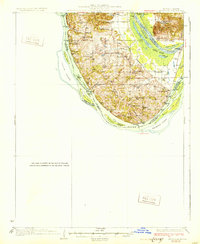
1931 Map of Brussels
USGS Topo · Published 1931About this map
The southern tip of Calhoun County, Illinois, is defined by the dramatic confluence where the Illinois River meets the Mississippi River. This 1931 edition reveals a landscape deeply connected to these waterways, where numerous river landings such as Dogtown Ldg, Hastings Ldg, and Brock Ldg served as vital conduits for commerce and travel. The interior is a network of ridges and hollows, punctuated by local landmarks like Indian Hill and Tucker Knob. A string of rural schoolhouses, including Hartford Sch, Nichols Sch, and Keck Sch, indicates the distributed nature of the upland farming communities during this era.
Find a feature on this map
70 named features on this map. Tap any name to fly to it.
Don’t see what you’re looking for? This feature index may not catch every label — zoom into the map to look around manually.
Map Details
Editions of this 1931 Brussels Map
2 editions found
Other maps of this area

1903 · O'Fallon
USGS Topo · 1:125,000

1924 · Robertson
USGS Topo · 1:24,000

1927 · St. Charles
USGS Topo · 1:62,500

1930 · Hardin
USGS Topo · 1:62,500

1930 · Jerseyville
USGS Topo · 1:62,500

1931 · Brussels
USGS Topo · 1:62,500

1932 · Manchester NE
USGS Topo · 1:24,000

1933 · Creve Coeur
USGS Topo · 1:24,000

1933 · Jerseyville
USGS Topo · 1:62,500

1933 · Saint Charles
USGS Topo · 1:62,500