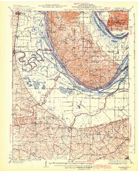
1943 Map of Brussels
USGS Topo · Published 1943About this map
The confluence of the Mississippi River and the Illinois River dominates this mid-century survey, revealing a landscape defined by seasonal sloughs, islands, and river-bottom agriculture. Along the northern bluffs, Pere Marquette State Park and Cap au Gris overlook a complex network of waterways including Sixmile Slough and Turkey Island. The southern portion of the map transitions into the growing settlements of O'Fallon, St Peters, and the northern edge of St Charles, where the Wabash RR and the historic Boones Lick Road facilitated movement across the plains.
Find a feature on this map
101 named features on this map. Tap any name to fly to it.
Don’t see what you’re looking for? This feature index may not catch every label — zoom into the map to look around manually.
Map Details
Editions of this 1943 Brussels Map
2 editions found

Other maps of this area

1903 · O'Fallon
USGS Topo · 1:125,000

1924 · Robertson
USGS Topo · 1:24,000

1927 · St. Charles
USGS Topo · 1:62,500

1930 · Hardin
USGS Topo · 1:62,500

1930 · Jerseyville
USGS Topo · 1:62,500

1931 · Brussels
USGS Topo · 1:62,500

1932 · Manchester NE
USGS Topo · 1:24,000

1933 · Creve Coeur
USGS Topo · 1:24,000

1933 · Jerseyville
USGS Topo · 1:62,500

1933 · Saint Charles
USGS Topo · 1:62,500