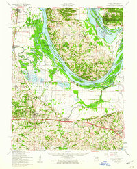
1954 Map of Brussels
USGS Topo · Published 1960About this map
The Mississippi River dominates this mid-century survey, defining the complex border between Illinois and Missouri where the Cuivre River and Peruque Creek join the main channel. The landscape is a network of sloughs, islands, and flood-protection structures like the McLean Levee. Notable settlements range from the established community of O'Fallon and St Peters to smaller river landings such as Dogtown Landing and Hastings Landing.
Find a feature on this map
113 named features on this map. Tap any name to fly to it.
Don’t see what you’re looking for? This feature index may not catch every label — zoom into the map to look around manually.
Map Details
Editions of this 1954 Brussels Map
2 editions found
Other maps of this area

1903 · O'Fallon
USGS Topo · 1:125,000

1924 · Robertson
USGS Topo · 1:24,000

1927 · St. Charles
USGS Topo · 1:62,500

1930 · Hardin
USGS Topo · 1:62,500

1930 · Jerseyville
USGS Topo · 1:62,500

1931 · Brussels
USGS Topo · 1:62,500

1932 · Manchester NE
USGS Topo · 1:24,000

1933 · Creve Coeur
USGS Topo · 1:24,000

1933 · Jerseyville
USGS Topo · 1:62,500

1933 · Saint Charles
USGS Topo · 1:62,500