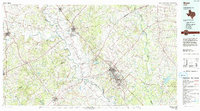
1993 Map of Bryan
USGS Topo · Published 1993About this map
The sprawling campus of Texas A&M University anchors the southeastern portion of this landscape, marking the transition from the university town of College Station into the Brazos Valley. The Brazos River and its tributary, the Little Brazos River, carve a broad alluvial valley that historically supported the region's agricultural economy. This corridor is flanked by major rail lines, including the Missouri Pacific RR and the Southern Pacific RR, which converge at the junction town of Hearne.
Find a feature on this map
127 named features on this map. Tap any name to fly to it.
Don’t see what you’re looking for? This feature index may not catch every label — zoom into the map to look around manually.
Map Details
Editions of this 1993 Bryan Map
This is the sole edition of this map. No revisions or reprints were ever made.
Other maps of this area

1885 · Taylor
USGS Topo · 1:125,000

1885 · Bastrop
USGS Topo · 1:125,000

1887 · Taylor
USGS Topo · 1:125,000

1892 · Temple
USGS Topo · 1:125,000

1893 · Bastrop
USGS Topo · 1:125,000

1894 · Taylor
USGS Topo · 1:125,000

1904 · Bastrop
USGS Topo · 1:125,000

1913 · Millican
USGS Topo · 1:31,680

1914 · Gay Hill
USGS Topo · 1:62,500

1914 · Navasota
USGS Topo · 1:62,500