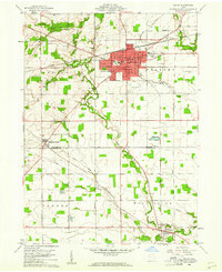
1960 Map of Bryan
USGS Topo · Published 1961About this map
The city of Bryan serves as a prominent focal point in this 1960s study of Williams and Defiance Counties, showcasing a dense grid of streets including Trevitt St, Butler St, and Main St. The surrounding countryside reveals a landscape defined by the winding course of Lick Creek and Little Lick Creek, interspersed with small agrarian communities and essential local landmarks. Genealogy researchers will find significant value in the distribution of family-named landmarks and rural institutions, such as Brown Cem, Fetters Cem, and Lick Creek Ch. The industrial and social life of the era is evident through the path of the New York Central railroad and the presence of a Drive-in Theater on the city's outskirts. The transition from the urban center of Bryan to the outlying settlements of Williams Center and Ney illustrates the mid-century development patterns of Northwest Ohio before modern suburbanization.
Find a feature on this map
49 named features on this map. Tap any name to fly to it.
Don’t see what you’re looking for? This feature index may not catch every label — zoom into the map to look around manually.
Map Details
Editions of this 1960 Bryan Map
4 editions found
Other maps of this area

1907 · Defiance
USGS Topo · 1:62,500

1909 · Defiance
USGS Topo · 1:62,500

1913 · Alvordton
USGS Topo · 1:62,500

1914 · Pioneer
USGS Topo · 1:62,500

1914 · Bryan
USGS Topo · 1:62,500

1943 · Bryan
USGS Topo · 1:62,500

1944 · Pioneer
USGS Topo · 1:62,500

1944 · Alvordton
USGS Topo · 1:62,500

1953 · Fort Wayne
USGS Topo · 1:250,000

1956 · Fort Wayne
USGS Topo · 1:250,000