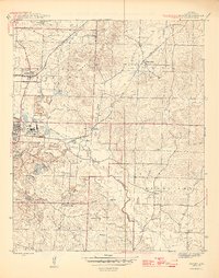
1944 Map of Bryant
USGS Topo · Published 1946About this map
Aluminum production and medical history define this mid-1940s landscape in Saline County. The industrial operations at Bauxite are central to the area, supported by the dedicated Bauxite Northern and Chicago Rock Island and Pacific railroads. Nearby, the specialized settlement of Pine Haven and the locality of Lignite suggest the extraction-based economy that drove local growth during the war era. Further north, the Thomas Mcrae Tuberculosis Home stands on a hill above Crooked Creek, representing a significant regional healthcare facility of the period.
Find a feature on this map
39 named features on this map. Tap any name to fly to it.
Don’t see what you’re looking for? This feature index may not catch every label — zoom into the map to look around manually.
Map Details
Editions of this 1944 Bryant Map
2 editions found

Other maps of this area

1890 · Benton
USGS Topo · 1:125,000

1891 · Little Rock
USGS Topo · 1:125,000

1893 · Little Rock
USGS Topo · 1:125,000

1894 · Benton
USGS Topo · 1:125,000

1935 · Little Rock
USGS Topo · 1:24,000

1935 · Alexander
USGS Topo · 1:48,000

1938 · Benton
USGS Topo · 1:48,000

1941 · Alexander
USGS Topo · 1:62,500

1944 · Benton
USGS Topo · 1:62,500

1944 · Alexander
USGS Topo · 1:31,680