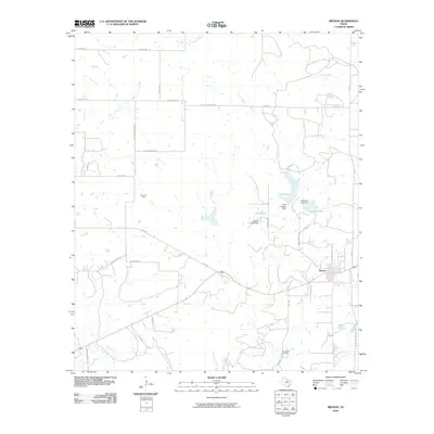
2010 Map of Bryson
USGS Topo · Published 2010About this map
Bryson sits at the intersection of local routes in Jack County, surrounded by a landscape defined by ranching and resource extraction. The northern portion of the quadrangle is largely defined by the Knox Oil Field, while the topography to the south and east is punctuated by significant water management features. Lake Bryson and McCloud Lake serve as focal points for the local hydrology, with their respective structures, the Lake Bryson Dam and McCloud Lake Dam, regulating flow into West Rock Creek.
Find a feature on this map
41 named features on this map. Tap any name to fly to it.
Don’t see what you’re looking for? This feature index may not catch every label — zoom into the map to look around manually.
Map Details
Editions of this 2010 Bryson Map
This is the sole edition of this map. No revisions or reprints were ever made.
Other maps of this area

1924 · Graham 4-d
USGS Topo · 1:48,000

1927 · Graham
USGS Topo · 1:62,500

1954 · Wichita Falls
USGS Topo · 1:250,000

1958 · Wichita Falls
USGS Topo · 1:250,000

1964 · Senate
USGS Topo · 1:24,000

1964 · Loving
USGS Topo · 1:24,000

1964 · Bryson
USGS Topo · 1:24,000

1964 · Lake Eddleman
USGS Topo · 1:24,000

1964 · Lynn Creek
USGS Topo · 1:24,000
1964 · Markley
USGS Topo · 1:24,000