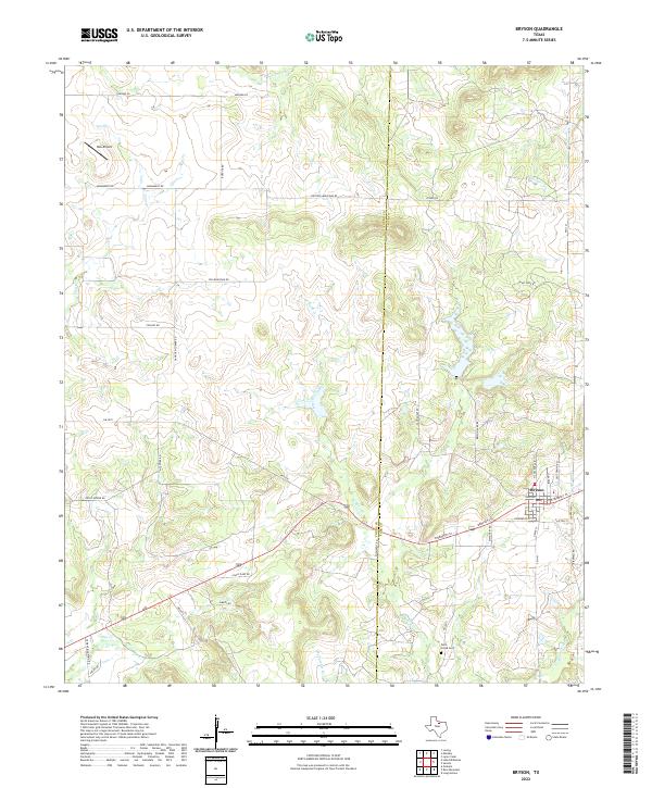
2022 Map of Bryson
USGS Topo · Published 2022About this map
Bryson sits at the intersection of local routes and natural drainages on the border of Young and Jack counties. This modern topographic view shows the town's street grid, including N College Ave and E Dempsey St, as it serves the surrounding cattle and oil country. The landscape is defined by the winding paths of West Rock Creek and Cameron Cr, which carve through a terrain dotted with family-named landmarks and rural infrastructure. Genealogists and local historians will find the Rock Creek Cem south of town particularly significant, along with early transportation corridors like Gahagan Corner Rd and Rooters Mountain Rd. Small aviation facilities such as Rob Airport and numerous rural junctions like those at FM 2075 and FM 1191 illustrate the contemporary spatial organization of this North Texas community.
Find a feature on this map
51 named features on this map. Tap any name to fly to it.
Don’t see what you’re looking for? This feature index may not catch every label — zoom into the map to look around manually.
Map Details
Editions of this 2022 Bryson Map
This is the sole edition of this map. No revisions or reprints were ever made.
Other maps of this area

1924 · Graham 4-d
USGS Topo · 1:48,000

1927 · Graham
USGS Topo · 1:62,500

1954 · Wichita Falls
USGS Topo · 1:250,000

1958 · Wichita Falls
USGS Topo · 1:250,000

1964 · Senate
USGS Topo · 1:24,000

1964 · Loving
USGS Topo · 1:24,000

1964 · Bryson
USGS Topo · 1:24,000

1964 · Lake Eddleman
USGS Topo · 1:24,000

1964 · Lynn Creek
USGS Topo · 1:24,000
1964 · Markley
USGS Topo · 1:24,000