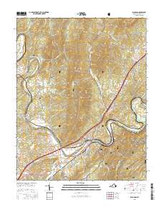
2016 Map of Buchanan
USGS Topo · Published 2016About this map
The town of Buchanan sits at a critical junction of the James River and the eastern ridges of the Appalachian range, where the river winds through The Gorge. This mid-2010s survey details the local infrastructure supporting this historic river crossing, including the Springwood Truss Bridge to the west near Springwood. The landscape is dominated by the ridges of Purgatory Mtn and Cove Mtn, much of which is preserved within the Jefferson National Forest. Local family and community history is preserved in several scattered burial grounds, such as Fairview Cem and Mays Cem. The map illustrates a complex network of mountain gaps, including Cartmell Gap and Cherry Orchard Gap, which have historically dictated travel and settlement patterns between the ridges of Back Creek Mtn and the Short Hills.
Find a feature on this map
82 named features on this map. Tap any name to fly to it.
Don’t see what you’re looking for? This feature index may not catch every label — zoom into the map to look around manually.
Map Details
Editions of this 2016 Buchanan Map
This is the sole edition of this map. No revisions or reprints were ever made.
Other maps of this area

1890 · Roanoke
USGS Topo · 1:125,000

1891 · Roanoke
USGS Topo · 1:125,000

1894 · Natural Bridge
USGS Topo · 1:125,000

1894 · Natural Bridge
USGS Topo · 1:62,500

1907 · Natural Bridge Special
USGS Topo · 1:62,500

1913 · Eagle Rock
USGS Topo · 1:48,000

1915 · Eagle Rock
USGS Topo · 1:62,500

1929 · Roanoke
USGS Topo · 1:48,000

1933 · Roanoke
USGS Topo · 1:62,500

1947 · Roanoke
USGS Topo · 1:250,000