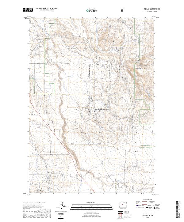
2023 Map of Buck Butte
USGS Topo · Published 2023About this map
Crooked River National Grassland dominates this central Oregon landscape, a region defined by high-desert terrain and vital water sources. The map reveals an intricate network of desert hydrology, where Willow Creek and Gray Butte Creek wind through the volcanic topography. Numerous named water sources, such as Cottonwood Spring, North Combs Spring, and McMeen Spring, highlight the essential nature of water in this arid environment, often serving as the primary anchors for local activity.
Find a feature on this map
34 named features on this map. Tap any name to fly to it.
Don’t see what you’re looking for? This feature index may not catch every label — zoom into the map to look around manually.
Map Details
Editions of this 2023 Buck Butte Map
This is the sole edition of this map. No revisions or reprints were ever made.
Other maps of this area

1926 · Bend
USGS Topo · 1:125,000

1928 · Madras
USGS Topo · 1:125,000

1929 · Bend
USGS Topo · 1:125,000

1931 · Madras
USGS Topo · 1:125,000

1955 · Bend
USGS Topo · 1:250,000

1957 · Bend
USGS Topo · 1:250,000

1958 · Bend
USGS Topo · 1:250,000

1962 · Opal City
USGS Topo · 1:24,000
1962 · Gray Butte
USGS Topo · 1:24,000

1962 · Prineville
USGS Topo · 1:62,500