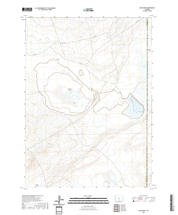
2021 Map of Buck Draw
USGS Topo · Published 2021About this map
Mahoney Lakes anchor the eastern landscape of this high-desert region on the border of Sweetwater and Carbon counties. This 2021 survey reveals a vast, internally draining topography characterized by wide alkaline basins and intermittent water systems. The map traces the transition between Separation Flats and the depressed alkaline terrain of Mud Lake Flats, offering a clear view of the arid hydrology and local road networks like Stratton Rd that navigate this portion of the Red Desert. This specific quadrangle is essential for understanding the modern footprint of land management and transportation in one of Wyoming's most open environments, where the namesake Buck Draw channels seasonal runoff through the southern reaches of the township.
Find a feature on this map
13 named features on this map. Tap any name to fly to it.
Don’t see what you’re looking for? This feature index may not catch every label — zoom into the map to look around manually.
Map Details
Editions of this 2021 Buck Draw Map
This is the sole edition of this map. No revisions or reprints were ever made.
Other maps of this area

1954 · Rawlins
USGS Topo · 1:250,000

1955 · Casper
USGS Topo · 1:250,000

1956 · Rawlins Peak
USGS Topo · 1:62,500

1958 · Rawlins
USGS Topo · 1:250,000

1958 · Casper
USGS Topo · 1:250,000

1960 · Larsen Knoll
USGS Topo · 1:24,000

1960 · Separation Rim
USGS Topo · 1:24,000

1960 · Bull Springs
USGS Topo · 1:24,000

1960 · Buck Draw
USGS Topo · 1:24,000

1960 · Chicken Spring
USGS Topo · 1:24,000