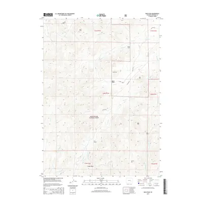
2015 Map of Buck Peak
USGS Topo · Published 2015About this map
The Medicine Bow National Forest dominates this section of Converse County, where the Laramie Mountains transition into a landscape of high summits and deep drainages. Significant landmarks like Buck Peak and Lookout Peak overlook a network of seasonal and perennial watercourses, including the westward-flowing Horse Cr and the winding Box Elder Cr. The human footprint in this part of Wyoming is characterized by scattered ranching outposts and family sites such as Buck Place and Leahy Place, connected by primitive routes like Boxelder Rd and Gunnysock Rd. Topographic features like Fire Canyon and Negro Gulch emphasize the complex erosional patterns of the high plains, providing a detailed view of the area before modern land-use changes might alter these remote cattle-country homesteads.
Find a feature on this map
37 named features on this map. Tap any name to fly to it.
Don’t see what you’re looking for? This feature index may not catch every label — zoom into the map to look around manually.
Map Details
Editions of this 2015 Buck Peak Map
This is the sole edition of this map. No revisions or reprints were ever made.
Other maps of this area

1954 · Torrington
USGS Topo · 1:250,000

1955 · Casper
USGS Topo · 1:250,000

1958 · Casper
USGS Topo · 1:250,000

1958 · Torrington
USGS Topo · 1:250,000

1959 · Squaw Spring
USGS Topo · 1:24,000

1960 · Banner Mtn
USGS Topo · 1:24,000

1960 · Reno Hill
USGS Topo · 1:24,000

1962 · Casper
USGS Topo · 1:250,000

1964 · Buck Peak
USGS Topo · 1:24,000

1964 · Buffalo Peak
USGS Topo · 1:24,000