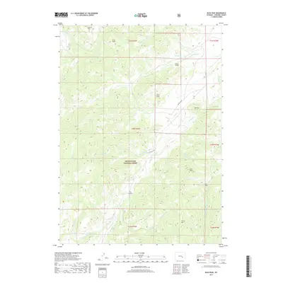
2017 Map of Buck Peak
USGS Topo · Published 2017About this map
The Medicine Bow National Forest dominates the high-altitude terrain of Converse County in this 2017 survey. The landscape is defined by a series of prominent summits including Lookout Peak, Davis Peak, and the namesake Buck Peak, which rises above a complex network of drainage basins. Water flows through numerous seasonal and perennial systems such as Box Elder Creek and Snowshoe Creek, which carve deep through the forest. Evidence of early land management and transit is visible in features like Lester's Grant and the path of Gunnysock Rd, while the presence of Keely Draw and Negro Gulch reflects a history of localized naming for specific topographic depressions. To the south, the terrain transitions toward Cherry Mountain, showcasing the dramatic elevation changes and geological variety typical of this section of the Laramie Range.
Find a feature on this map
33 named features on this map. Tap any name to fly to it.
Don’t see what you’re looking for? This feature index may not catch every label — zoom into the map to look around manually.
Map Details
Editions of this 2017 Buck Peak Map
This is the sole edition of this map. No revisions or reprints were ever made.
Other maps of this area

1954 · Torrington
USGS Topo · 1:250,000

1955 · Casper
USGS Topo · 1:250,000

1958 · Casper
USGS Topo · 1:250,000

1958 · Torrington
USGS Topo · 1:250,000

1959 · Squaw Spring
USGS Topo · 1:24,000

1960 · Banner Mtn
USGS Topo · 1:24,000

1960 · Reno Hill
USGS Topo · 1:24,000

1962 · Casper
USGS Topo · 1:250,000

1964 · Buck Peak
USGS Topo · 1:24,000

1964 · Buffalo Peak
USGS Topo · 1:24,000