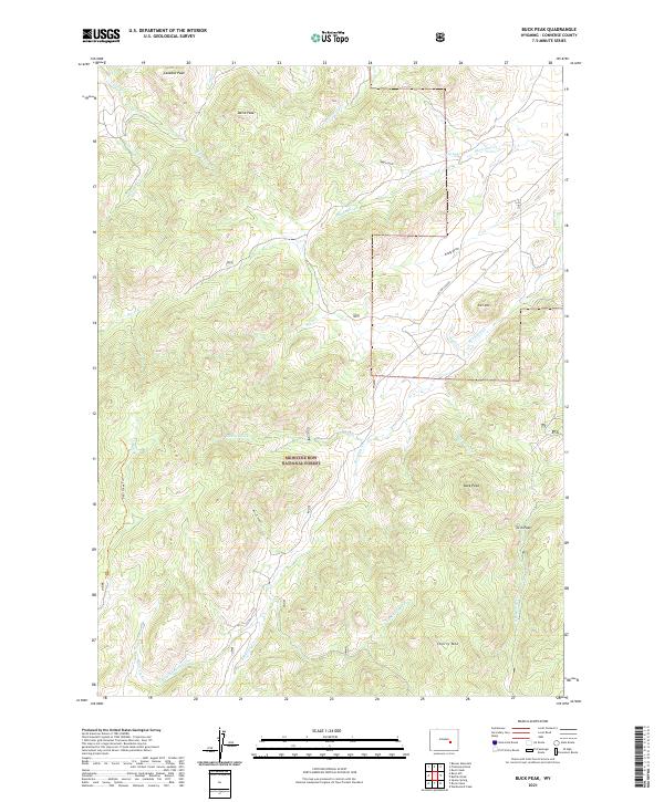
2021 Map of Buck Peak
USGS Topo · Published 2021About this map
Medicine Bow National Forest dominates this Wyoming landscape, where steep drainages and high summits define the southern Converse County terrain. The survey details the complex network of creeks that feed the region, including Box Elder Creek and Buck Creek, which carve through the high country. Several prominent summits serve as landmarks, from the central heights of Buck Peak and Pole Mountain to Lookout Peak and Davis Peak in the north. The topography reveals a land managed for both natural preservation and local access, evidenced by the presence of Deer Creek Trail and County Road 17. Named features like Lester's Grant, Keely Draw, and Negro Gulch provide specific points of interest for those tracing land use history or historical place names in this part of the Laramie Range foothills.
Find a feature on this map
32 named features on this map. Tap any name to fly to it.
Don’t see what you’re looking for? This feature index may not catch every label — zoom into the map to look around manually.
Map Details
Editions of this 2021 Buck Peak Map
This is the sole edition of this map. No revisions or reprints were ever made.
Other maps of this area

1954 · Torrington
USGS Topo · 1:250,000

1955 · Casper
USGS Topo · 1:250,000

1958 · Casper
USGS Topo · 1:250,000

1958 · Torrington
USGS Topo · 1:250,000

1959 · Squaw Spring
USGS Topo · 1:24,000

1960 · Banner Mtn
USGS Topo · 1:24,000

1960 · Reno Hill
USGS Topo · 1:24,000

1962 · Casper
USGS Topo · 1:250,000

1964 · Buck Peak
USGS Topo · 1:24,000

1964 · Buffalo Peak
USGS Topo · 1:24,000