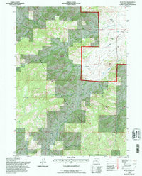
1992 Map of Buck Peak
USGS Topo · Published 1996About this map
Medicine Bow National Forest dominates this Wyoming landscape, where the high-altitude terrain of Converse County is defined by the Laramie Range. The 1990s revision reveals a network of isolated ranching and homestead sites, including Snowshoe Ranch in the north and the Buck Place and Leahy Place further south. These named locations, often situated near water sources like Strawberry Creek and Box Elder Creek, reflect the persistent human presence in this demanding environment.
Find a feature on this map
25 named features on this map. Tap any name to fly to it.
Don’t see what you’re looking for? This feature index may not catch every label — zoom into the map to look around manually.
Map Details
Editions of this 1992 Buck Peak Map
This is the sole edition of this map. No revisions or reprints were ever made.
Other maps of this area

1954 · Torrington
USGS Topo · 1:250,000

1955 · Casper
USGS Topo · 1:250,000

1958 · Casper
USGS Topo · 1:250,000

1958 · Torrington
USGS Topo · 1:250,000

1959 · Squaw Spring
USGS Topo · 1:24,000

1960 · Banner Mtn
USGS Topo · 1:24,000

1960 · Reno Hill
USGS Topo · 1:24,000

1962 · Casper
USGS Topo · 1:250,000

1964 · Buck Peak
USGS Topo · 1:24,000

1964 · Buffalo Peak
USGS Topo · 1:24,000