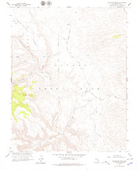
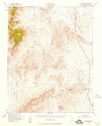
1961 Map of Buckboard Mesa
USGS Topo · Published 1979About this map
The Nevada Test Site dominates this 1961 landscape, a high-desert environment shaped by both ancient human presence and modern atomic-era research. Collaborative mapping by the Geological Survey and the Atomic Energy Commission reveals a terrain marked by numerous Test Sites and a Test Site drilling hole, reflecting the mid-century intensification of military and scientific operations in the Great Basin. An Abandoned Airstrip sits near the Boundary Area, while Tippipah Road provides access through the high plateaus.
Find a feature on this map
16 named features on this map. Tap any name to fly to it.
Don’t see what you’re looking for? This feature index may not catch every label — zoom into the map to look around manually.
Map Details
Editions of this 1961 Buckboard Mesa Map
4 editions found
Other maps of this area

1908 · Kawich
USGS Topo · 1:250,000

1908 · Furnace Creek
USGS Topo · 1:250,000

1910 · Furnace Creek
USGS Topo · 1:250,000

1942 · Wheelbarrow Peak
USGS Topo · 1:125,000

1942 · Skull Mountain
USGS Topo · 1:125,000

1948 · Death Valley
USGS Topo · 1:250,000

1952 · Topopah Spring
USGS Topo · 1:62,500

1952 · Tippipah Spring
USGS Topo · 1:62,500

1952 · Timber Mountain
USGS Topo · 1:62,500
1952 · Cane Spring
USGS Topo · 1:62,500