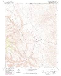
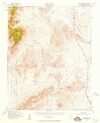
1961 Map of Buckboard Mesa
USGS Topo · Published 1984About this map
Nevada Test Site operations define this Cold War landscape, where scientific infrastructure meets ancient history. The map documents multiple Test Sites, a Drill Hole, and specialized facilities situated across the flat expanse of Buckboard Mesa. Below these plateaus, the terrain drops sharply into the winding reaches of Fortymile Canyon. While the era was defined by atomic research, the survey also captures indelible traces of much earlier inhabitants, marking several locations of Indian Petroglyphs and a Cave along the canyon walls. Transportation through this restricted zone is limited to specialized routes like Tippipah Spring Road and the Shoshone Trail, which navigate the complex network of drainage systems including Brushy Canyon and Cat Canyon. This document reveals a unique moment where mid-century defense needs were mapped over the long-standing physical and cultural geography of the high desert.
Find a feature on this map
14 named features on this map. Tap any name to fly to it.
Don’t see what you’re looking for? This feature index may not catch every label — zoom into the map to look around manually.
Map Details
Editions of this 1961 Buckboard Mesa Map
4 editions found
Other maps of this area

1908 · Kawich
USGS Topo · 1:250,000

1908 · Furnace Creek
USGS Topo · 1:250,000

1910 · Furnace Creek
USGS Topo · 1:250,000

1942 · Wheelbarrow Peak
USGS Topo · 1:125,000

1942 · Skull Mountain
USGS Topo · 1:125,000

1948 · Death Valley
USGS Topo · 1:250,000

1952 · Topopah Spring
USGS Topo · 1:62,500

1952 · Tippipah Spring
USGS Topo · 1:62,500

1952 · Timber Mountain
USGS Topo · 1:62,500
1952 · Cane Spring
USGS Topo · 1:62,500