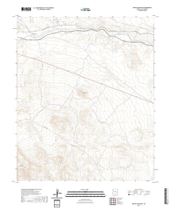
2021 Map of Bucket Mountain
USGS Topo · Published 2021About this map
Gilson Wash meanders across the northern corridor of this Gila County landscape, paralleled by the historical route of Old San Carlos Rd. The terrain is defined by prominent peaks, including Bucket Mtn at the center and Hog Mtn to the southwest, which dictate the drainage patterns for the surrounding canyons and washes. The distribution of water resources in this arid region is marked by a network of tanks and natural springs, such as Dripping Springs, Chalk Tank, and Copper Mountain Tank. These features, combined with the presence of Coolidge Dam Rd and various numbered access roads, suggest a landscape managed for cattle ranching and transit through the high desert between major peaks. The mapping reveals the essential relationship between elevation and water access in the remote Arizona backcountry.
Find a feature on this map
22 named features on this map. Tap any name to fly to it.
Don’t see what you’re looking for? This feature index may not catch every label — zoom into the map to look around manually.
Map Details
Editions of this 2021 Bucket Mountain Map
This is the sole edition of this map. No revisions or reprints were ever made.
Other maps of this area

1915 · Christmas
USGS Topo · 1:62,500

1917 · Christmas
USGS Topo · 1:62,500

1954 · Mesa
USGS Topo · 1:250,000

1957 · Mesa
USGS Topo · 1:250,000

1958 · Mesa
USGS Topo · 1:250,000

1960 · Mesa
USGS Topo · 1:250,000

1962 · San Carlos Reservoir
USGS Topo · 1:62,500

1964 · Mesa
USGS Topo · 1:250,000

1965 · Bucket Mtn
USGS Topo · 1:24,000

1966 · Natural Corral
USGS Topo · 1:24,000