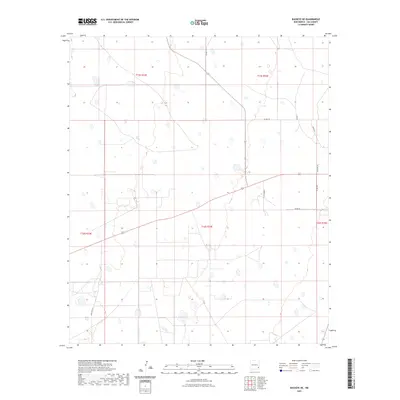
2023 Map of Buckeye NE
USGS Topo · Published 2023About this map
The high plains of Lea County appear here as a landscape defined by ranching life and a sparse, geometric grid of rural roads. The T C H Ranch serves as a primary landmark in this section of the Permian Basin, where the terrain is marked by ephemeral depressions and broad plateaus. The U.S. Department of the Interior documentation shows how modern access routes like Elliot Rd and Williams Rd partition the vast ranchlands into townships and ranges, including t16s r34e and t15s r34e. This survey provides a precise look at the contemporary infrastructure that supports the region's agricultural and energy-adjacent activities, tracing quiet lanes such as Dan Ln and Ashly Ln that lead to isolated homesteads and industrial sites.
Find a feature on this map
14 named features on this map. Tap any name to fly to it.
Don’t see what you’re looking for? This feature index may not catch every label — zoom into the map to look around manually.
Map Details
Editions of this 2023 Buckeye NE Map
This is the sole edition of this map. No revisions or reprints were ever made.
Other maps of this area

1954 · Hobbs
USGS Topo · 1:250,000

1954 · Brownfield
USGS Topo · 1:250,000

1958 · Brownfield
USGS Topo · 1:250,000

1958 · Hobbs
USGS Topo · 1:250,000

1962 · Brownfield
USGS Topo · 1:250,000

1962 · Lovington
USGS Topo · 1:62,500

1962 · Buckeye
USGS Topo · 1:62,500

1970 · Hillburn City SW
USGS Topo · 1:24,000

1973 · Fort Ranch
USGS Topo · 1:24,000

1973 · Dean Ranch
USGS Topo · 1:24,000