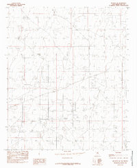
1985 Map of Buckeye NE
USGS Topo · Published 1985About this map
Industrial infrastructure and the extraction economy of the Permian Basin characterize this corner of Lea County. The landscape is heavily marked by an extensive Oil Field, with numerous wells and access roads stretching across the high desert plains. A significant Aqueduct traverses the southwestern portion of the map, indicating the vital role of water management in this arid region. Near the southern boundary, a Gravel Pit points to local material sourcing for the area's development. This 1985 provisional edition, based on earlier aerial photography and field checks, provides a technical record of a terrain defined by its underground resources rather than traditional residential settlements.
Find a feature on this map
4 named features on this map. Tap any name to fly to it.
Don’t see what you’re looking for? This feature index may not catch every label — zoom into the map to look around manually.
Map Details
Editions of this 1985 Buckeye NE Map
This is the sole edition of this map. No revisions or reprints were ever made.
Other maps of this area

1954 · Hobbs
USGS Topo · 1:250,000

1954 · Brownfield
USGS Topo · 1:250,000

1958 · Brownfield
USGS Topo · 1:250,000

1958 · Hobbs
USGS Topo · 1:250,000

1962 · Brownfield
USGS Topo · 1:250,000

1962 · Lovington
USGS Topo · 1:62,500

1962 · Buckeye
USGS Topo · 1:62,500

1970 · Hillburn City SW
USGS Topo · 1:24,000

1973 · Fort Ranch
USGS Topo · 1:24,000

1973 · Dean Ranch
USGS Topo · 1:24,000