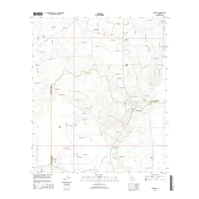
2015 Map of Buckeye
USGS Topo · Published 2015About this map
Buckeye and Deville anchor this Central Louisiana landscape where the elevated terrain of Big Island rises above the surrounding wetlands and drainage systems. The map details a complex network of bayous and creeks, including Cainey Bayou and Big Creek, which define the low-lying areas between the extensive prairie lands of Little Prairie, Vasher Prairie, and Long Prairie.
Find a feature on this map
105 named features on this map. Tap any name to fly to it.
Don’t see what you’re looking for? This feature index may not catch every label — zoom into the map to look around manually.
Map Details
Editions of this 2015 Buckeye Map
This is the sole edition of this map. No revisions or reprints were ever made.
Other maps of this area

1935 · Lecompte
USGS Topo · 1:62,500

1940 · Marksville
USGS Topo · 1:62,500

1941 · Alexandria
USGS Topo · 1:62,500

1941 · Buckeye
USGS Topo · 1:62,500

1953 · Alexandria
USGS Topo · 1:250,000

1955 · Alexandria
USGS Topo · 1:250,000

1957 · Alexandria
USGS Topo · 1:62,500

1957 · Lecompte
USGS Topo · 1:62,500

1959 · Buckeye
USGS Topo · 1:62,500
1962 · Marksville
USGS Topo · 1:62,500