Loading...
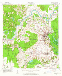
Loading map...1962 Map of Marksville
USGS Topo · Published 1964About this map
Marksville and the surrounding Avoyelles Prairie dominate this early 1960s landscape, where the meandering Red River and Little River define the local geography. The settlement pattern is deeply tied to the high ground above the wetlands, with towns like Mansura and Hessmer situated along the rail corridors of the Kansas City Southern and Texas and Pacific. This era captures a transition in transport, showing the intricate network of parish roads connecting rural landmarks such as St Marys Ch and St Pauls Ch.
Find a feature on this map
111 named features on this map. Tap any name to fly to it.
Don’t see what you’re looking for? This feature index may not catch every label — zoom into the map to look around manually.
Map Details
Date Portrayed1962
Date Published1964
PublisherU.S. Geological Survey
Map TypeTopographic
Scale1:62,500
Physical Dimensions16.9 x 20.8 inches
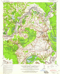
Editions of this 1962 Marksville Map
3 editions found
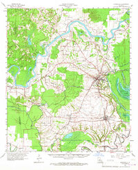
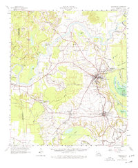
Historical Maps of Marksville Through Time
Featured Locations
Source Details
SourceU.S. Geological Survey
CopyrightPublic Domain