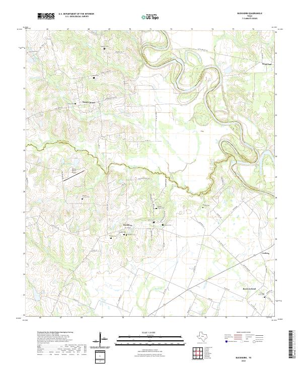
2022 Map of Buckhorn
USGS Topo · Published 2022About this map
The Brazos River meanders along the eastern edge of this territory, forming a natural boundary shared by Austin, Washington, and Waller counties. The landscape is defined by the rural settlements of Buckhorn, Sauney Stand, and Raccoon Bend, where the terrain transitions from the river's fertile bottomlands to higher ground marked by scattered family and community burial sites. Genealogists will find a high concentration of historic resting places, including Washam Cem, Buckhorn Cem, and the Samuel Chapel Cem near the center of the sheet.
Find a feature on this map
71 named features on this map. Tap any name to fly to it.
Don’t see what you’re looking for? This feature index may not catch every label — zoom into the map to look around manually.
Map Details
Editions of this 2022 Buckhorn Map
This is the sole edition of this map. No revisions or reprints were ever made.
Other maps of this area

1930 · Brenham
USGS Topo · 1:62,500

1953 · Seguin
USGS Topo · 1:250,000

1954 · Austin
USGS Topo · 1:250,000

1956 · Bellville
USGS Topo · 1:62,500

1956 · Sealy
USGS Topo · 1:62,500

1956 · Hempstead
USGS Topo · 1:62,500

1956 · Brenham
USGS Topo · 1:62,500

1958 · Seguin
USGS Topo · 1:250,000
1960 · Sunny Side
USGS Topo · 1:24,000
1961 · Burleigh
USGS Topo · 1:24,000