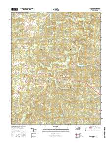
2016 Map of Buckingham
USGS Topo · Published 2016About this map
Buckingham Courthouse serves as the central hub of this Piedmont landscape, situated where local routes converge amidst a complex network of creeks and branches. The settlement patterns of central Virginia are visible in the clusters around Alcoma, Mount Rush, and Mount Vinco, connected by historic corridors like Slate River Mill Rd and Mulberry Grove Rd. The terrain is defined by the winding course of the Slate River and its numerous tributaries, including Ripley Cr and Troublesome Cr. Genealogists will find several burial sites recorded, such as Trinity Cem and Fork Union Cem. The presence of Wheatland Airport and Horesepen Lake provides modern landmarks within a region that maintains its traditional rural character, characterized by large plantations and scattered small-scale agriculture.
Find a feature on this map
78 named features on this map. Tap any name to fly to it.
Don’t see what you’re looking for? This feature index may not catch every label — zoom into the map to look around manually.
Map Details
Editions of this 2016 Buckingham Map
This is the sole edition of this map. No revisions or reprints were ever made.
Other maps of this area

1891 · Palmyra
USGS Topo · 1:125,000

1891 · Farmville
USGS Topo · 1:125,000

1892 · Buckingham
USGS Topo · 1:125,000

1892 · Appomattox
USGS Topo · 1:125,000

1893 · Farmville
USGS Topo · 1:125,000

1895 · Palmyra
USGS Topo · 1:125,000

1897 · Palmyra
USGS Topo · 1:125,000

1947 · Roanoke
USGS Topo · 1:250,000

1950 · Dillwyn
USGS Topo · 1:62,500

1958 · Farmville
USGS Topo · 1:62,500