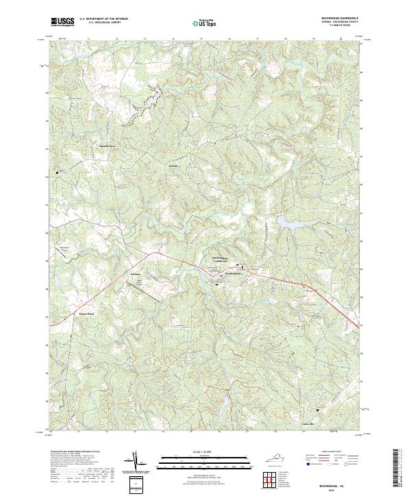
2022 Map of Buckingham
USGS Topo · Published 2022About this map
Buckingham Courthouse serves as the focal point of this Piedmont landscape, situated where several regional routes converge. The area is defined by the winding course of the Slate River and its numerous tributaries, including N River and Troublesome Cr. Settlement patterns follow the high ground between these drainages, with established communities like Katrine, Alcoma, and Enonville connected by historical corridors such as Slate River Mill Rd and Old Mill Rd. Local history is preserved in numerous scattered burial grounds, including the Mulberry Grove Cem near Mount Vinco and the Fork Union Cem near the courthouse. Aviation activity is noted at the Wheatland Airport and the Slate River Airpark, while the southern portion of the map features the expansive Horsepen Lake and its surrounding drainage network.
Find a feature on this map
84 named features on this map. Tap any name to fly to it.
Don’t see what you’re looking for? This feature index may not catch every label — zoom into the map to look around manually.
Map Details
Editions of this 2022 Buckingham Map
This is the sole edition of this map. No revisions or reprints were ever made.
Other maps of this area

1891 · Palmyra
USGS Topo · 1:125,000

1891 · Farmville
USGS Topo · 1:125,000

1892 · Buckingham
USGS Topo · 1:125,000

1892 · Appomattox
USGS Topo · 1:125,000

1893 · Farmville
USGS Topo · 1:125,000

1895 · Palmyra
USGS Topo · 1:125,000

1897 · Palmyra
USGS Topo · 1:125,000

1947 · Roanoke
USGS Topo · 1:250,000

1950 · Dillwyn
USGS Topo · 1:62,500

1958 · Farmville
USGS Topo · 1:62,500