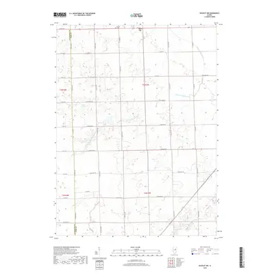
2018 Map of Buckley NW
USGS Topo · Published 2018About this map
Piper City stands as the primary hub in this agricultural landscape near the boundary of Livingston Co Ford Co. The terrain is characterized by the meandering path of the N Fork Vermilion River, which cuts through the central and southern portions of the region. The map reveals a highly structured grid of rural roads, such as E 2200 North Rd and N 1400 East Rd, which facilitate transport across the extensive farmland. Local history is anchored by sites like Brewton Cem located near the northern edge, and the small body of Laue Lake tucked into the western sections. The presence of Rte 115 and Co Hwy 13 indicates the developed connectivity between these prairie settlements and the surrounding Illinois countryside.
Find a feature on this map
29 named features on this map. Tap any name to fly to it.
Don’t see what you’re looking for? This feature index may not catch every label — zoom into the map to look around manually.
Map Details
Editions of this 2018 Buckley NW Map
This is the sole edition of this map. No revisions or reprints were ever made.
Other maps of this area

1944 · Piper City
USGS Topo · 1:48,000

1947 · Piper City
USGS Topo · 1:62,500

1947 · Sibley
USGS Topo · 1:62,500

1947 · Cullom
USGS Topo · 1:62,500

1948 · Buckley
USGS Topo · 1:62,500

1949 · Buckley
USGS Topo · 1:62,500

1949 · Cullom
USGS Topo · 1:62,500

1949 · Sibley
USGS Topo · 1:62,500

1958 · Peoria
USGS Topo · 1:250,000

1961 · Peoria
USGS Topo · 1:250,000