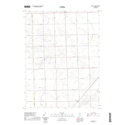
2021 Map of Buckley NW
USGS Topo · Published 2021About this map
Piper City serves as the primary settlement on this agricultural landscape in eastern Illinois, situated at the junction of Rte 115 and the railroad corridor. The terrain is defined by the winding course of the N Fork Vermilion River, which meanders through a grid of rural section roads. Local history is anchored by the Brenton Cem located just north of town, and the presence of Laue Lake to the west. The map illustrates a highly organized township structure where modern infrastructure like Co Hwy 13 follows long-established property lines. This late-stage survey captures the region's enduring character as a productive farming community, where the drainage of the North Fork remains a central geographic feature for land management and local life.
Find a feature on this map
26 named features on this map. Tap any name to fly to it.
Don’t see what you’re looking for? This feature index may not catch every label — zoom into the map to look around manually.
Map Details
Editions of this 2021 Buckley NW Map
This is the sole edition of this map. No revisions or reprints were ever made.
Other maps of this area

1944 · Piper City
USGS Topo · 1:48,000

1947 · Piper City
USGS Topo · 1:62,500

1947 · Sibley
USGS Topo · 1:62,500

1947 · Cullom
USGS Topo · 1:62,500

1948 · Buckley
USGS Topo · 1:62,500

1949 · Buckley
USGS Topo · 1:62,500

1949 · Cullom
USGS Topo · 1:62,500

1949 · Sibley
USGS Topo · 1:62,500

1958 · Peoria
USGS Topo · 1:250,000

1961 · Peoria
USGS Topo · 1:250,000