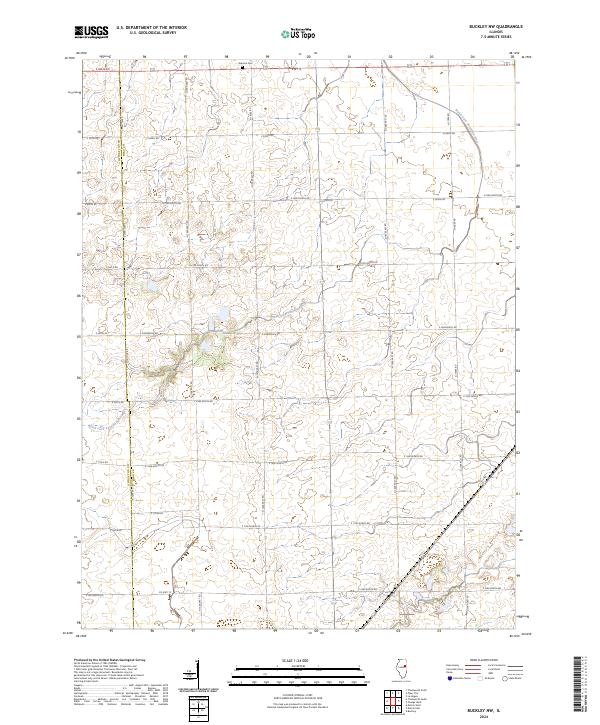
2024 Map of Buckley NW
USGS Topo · Published 2024About this map
The North Fork Vermilion River meanders across this rural section of the Illinois prairie, following a winding path through the borderlands of Ford and Livingston counties. The landscape is primarily defined by a rigid section-line grid of rural routes, such as E 2200 North Rd and N 1400 East Rd, which delineate the expansive agricultural fields characteristic of the region. Near the northern boundary, the Brenton Cem serves as a significant landmark for genealogical research, situated just off Rte 115. Further south, the terrain includes Lake Lake, a notable water feature in a landscape otherwise dominated by drainage patterns and straight-line county roads like Co Hwy 13. This survey illustrates the persistent rural character and the enduring infrastructure of the central Illinois farm belt.
Find a feature on this map
27 named features on this map. Tap any name to fly to it.
Don’t see what you’re looking for? This feature index may not catch every label — zoom into the map to look around manually.
Map Details
Editions of this 2024 Buckley NW Map
This is the sole edition of this map. No revisions or reprints were ever made.
Other maps of this area

1944 · Piper City
USGS Topo · 1:48,000

1947 · Piper City
USGS Topo · 1:62,500

1947 · Sibley
USGS Topo · 1:62,500

1947 · Cullom
USGS Topo · 1:62,500

1948 · Buckley
USGS Topo · 1:62,500

1949 · Buckley
USGS Topo · 1:62,500

1949 · Cullom
USGS Topo · 1:62,500

1949 · Sibley
USGS Topo · 1:62,500

1958 · Peoria
USGS Topo · 1:250,000

1961 · Peoria
USGS Topo · 1:250,000