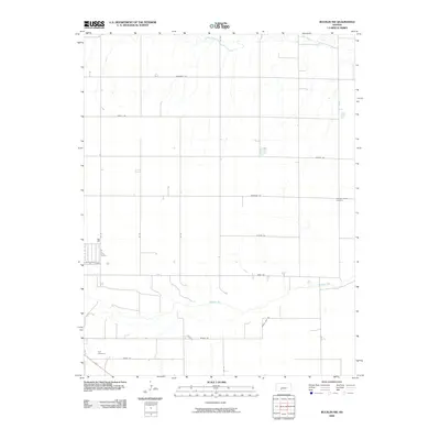
2009 Map of Bucklin NW
USGS Topo · Published 2009About this map
The Arkansas River flows through the southern section of this Ford County landscape, defining the local topography alongside Coon Creek to the north. This 2009 survey reveals a strictly organized rural grid system, where long-established burial grounds like Pleasant Valley Cemetery and Ford Cemetery serve as fixed points of reference for genealogists and local historians. The road network is particularly evocative of the area's heritage, featuring named routes such as Outlaw Rd, Quaker Rd, and Saddle Side Rd. These corridors, including Marshall Rd and Tilman Rd, connect the dispersed agricultural holdings across the Kansas plains, illustrating the enduring spatial logic of the region's land divisions into the early 21st century.
Find a feature on this map
18 named features on this map. Tap any name to fly to it.
Don’t see what you’re looking for? This feature index may not catch every label — zoom into the map to look around manually.
Map Details
Editions of this 2009 Bucklin NW Map
This is the sole edition of this map. No revisions or reprints were ever made.
Other maps of this area

1892 · Spearville
USGS Topo · 1:125,000

1894 · Spearville
USGS Topo · 1:125,000

1955 · Pratt
USGS Topo · 1:250,000

1959 · Pratt
USGS Topo · 1:250,000

1969 · Bucklin NE
USGS Topo · 1:24,000

1969 · Bucklin SE
USGS Topo · 1:24,000

1969 · Bucklin
USGS Topo · 1:24,000

1969 · Kingsdown
USGS Topo · 1:24,000

1969 · Bucklin NW
USGS Topo · 1:24,000

1969 · Ford
USGS Topo · 1:24,000