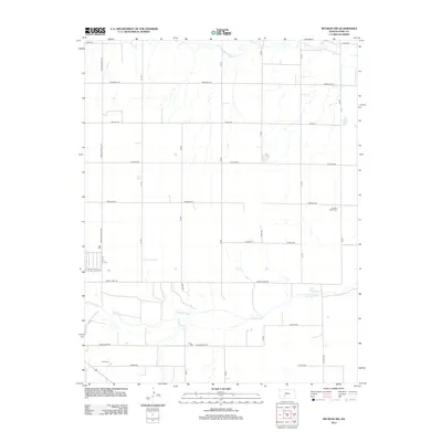
2012 Map of Bucklin NW
USGS Topo · Published 2012About this map
The Arkansas River winds through the southern landscape of this Kansas quadrangle, defining the local geography as it flows past the intersection of Saddle Side Rd and Bucklin Rd. The area is characterized by a strict orthogonal grid of rural roads, including storied names like Outlaw Rd and Liberty Trail Rd, reflecting the systematic land division of Ford County. North of the river, the intermittent drainage of Coon Cr cuts across the plains near Marshall Rd. For those researching local heritage, the map identifies key burial sites such as Pleasant Valley Cem in the east and Ford Cem to the southwest, providing specific coordinates for family history research. The presence of these cemeteries alongside the river valley and the expansive network of numbered and named section roads illustrates a long-standing agricultural community structured around the water's edge and the high prairie above it.
Find a feature on this map
26 named features on this map. Tap any name to fly to it.
Don’t see what you’re looking for? This feature index may not catch every label — zoom into the map to look around manually.
Map Details
Editions of this 2012 Bucklin NW Map
This is the sole edition of this map. No revisions or reprints were ever made.
Other maps of this area

1892 · Spearville
USGS Topo · 1:125,000

1894 · Spearville
USGS Topo · 1:125,000

1955 · Pratt
USGS Topo · 1:250,000

1959 · Pratt
USGS Topo · 1:250,000

1969 · Bucklin NE
USGS Topo · 1:24,000

1969 · Bucklin SE
USGS Topo · 1:24,000

1969 · Bucklin
USGS Topo · 1:24,000

1969 · Kingsdown
USGS Topo · 1:24,000

1969 · Bucklin NW
USGS Topo · 1:24,000

1969 · Ford
USGS Topo · 1:24,000