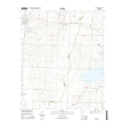
2014 Map of Buckner
USGS Topo · Published 2014About this map
The boundary between Lafayette and Columbia counties is defined by the winding course of Bayou Dorcheat, which bisects this southwest Arkansas landscape. The town of Stamps serves as the primary hub in the west, situated near Lake June and Crooked Branch. To the east, the Buckner Oil and Gas Field indicates the industrial character of the region, while the small settlements of Buckner, McKamie, and Apalco are scattered along the local road network and US Highway 82. Genealogists will find several burial sites throughout the quadrangle, including Buckner Cem, Lakeside Cem, and Patterson Cem. In the southeast, the waters of Lake Columbia begin to dominate the terrain, fed by creeks such as Beech Cr and Holly Cr. This digital revision of the topography provides a precise look at the rural intersections and watercourses that have shaped these timber and oil-producing lands for decades.
Find a feature on this map
87 named features on this map. Tap any name to fly to it.
Don’t see what you’re looking for? This feature index may not catch every label — zoom into the map to look around manually.
Map Details
Editions of this 2014 Buckner Map
This is the sole edition of this map. No revisions or reprints were ever made.
Other maps of this area

1952 · Bradley NE
USGS Topo · 1:24,000

1952 · Old Town
USGS Topo · 1:24,000

1952 · Lewisville
USGS Topo · 1:24,000

1953 · El Dorado
USGS Topo · 1:250,000

1957 · El Dorado
USGS Topo · 1:250,000

1958 · El Dorado
USGS Topo · 1:250,000

1960 · El Dorado
USGS Topo · 1:250,000

1960 · Bussey
USGS Topo · 1:24,000

1960 · Macedonia
USGS Topo · 1:24,000

1968 · Buckner
USGS Topo · 1:24,000