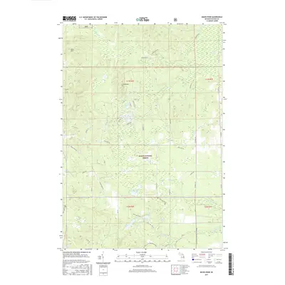
2017 Map of Bucks Pond
USGS Topo · Published 2017About this map
The Huron National Forest landscape in northern Michigan is defined by a dense network of glacial lakes, wetlands, and ridges. Central to this area is Bucks Pond, surrounded by specialized terrain features such as Chin Whisker Hill and the Kelly Hills. The presence of the Reid, 12-10 Railroad Grade in the south provides a window into the timber-era infrastructure that once crisscrossed these woods, now largely replaced by forest service roads and recreational paths. Water is the primary character of this quadrangle, ranging from named marshes like Big Marsh and Fannys Marsh to the tucked-away Lake in the Green. The southern portion is notably dominated by the Reid Lake Trails system, which circumnavigates Reid Lake and Trout Lake, tracing the high ground above the W Br Pine River.
Find a feature on this map
48 named features on this map. Tap any name to fly to it.
Don’t see what you’re looking for? This feature index may not catch every label — zoom into the map to look around manually.
Map Details
Editions of this 2017 Bucks Pond Map
This is the sole edition of this map. No revisions or reprints were ever made.
Other maps of this area

1954 · Tawas City
USGS Topo · 1:250,000

1958 · Tawas City
USGS Topo · 1:250,000

1959 · Glennie
USGS Topo · 1:62,500

1972 · Hubbard Lake
USGS Topo · 1:24,000

1972 · Curran
USGS Topo · 1:24,000

1972 · Hubbard Lake SW
USGS Topo · 1:24,000

1972 · Alcona Dam Pond
USGS Topo · 1:24,000
1972 · McGinn Creek
USGS Topo · 1:24,000

1983 · Hubbard Lake
USGS Topo · 1:100,000
1989 · Barton City
USGS Topo · 1:24,000