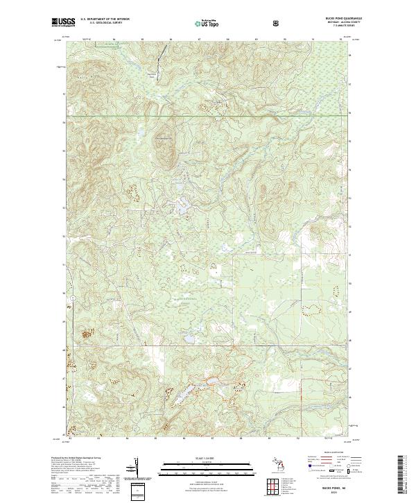
2023 Map of Bucks Pond
USGS Topo · Published 2023About this map
Wildcat Creek flows through the northern reaches of this landscape, situated within the bounds of the Huron National Forest. The terrain is defined by a dense network of forest service roads and drainage patterns typical of Alcona County's interior. This survey captures a moment in the modern management of these timberlands, showing the established grid of section lines and fire roads that facilitate access to the remote backcountry. The area is characterized by low topographic relief and extensive wetlands, providing a detailed record of the hydrological interface between minor tributaries and the larger regional watersheds.
Find a feature on this map
1 named feature on this map. Tap any name to fly to it.
Don’t see what you’re looking for? This feature index may not catch every label — zoom into the map to look around manually.
Map Details
Editions of this 2023 Bucks Pond Map
This is the sole edition of this map. No revisions or reprints were ever made.
Other maps of this area

1954 · Tawas City
USGS Topo · 1:250,000

1958 · Tawas City
USGS Topo · 1:250,000

1959 · Glennie
USGS Topo · 1:62,500

1972 · Hubbard Lake
USGS Topo · 1:24,000

1972 · Curran
USGS Topo · 1:24,000

1972 · Hubbard Lake SW
USGS Topo · 1:24,000

1972 · Alcona Dam Pond
USGS Topo · 1:24,000
1972 · McGinn Creek
USGS Topo · 1:24,000

1983 · Hubbard Lake
USGS Topo · 1:100,000
1989 · Barton City
USGS Topo · 1:24,000