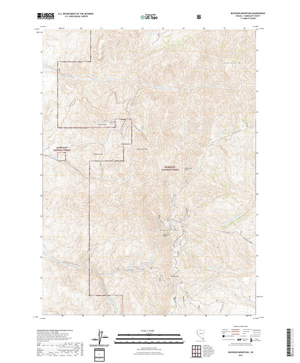
2021 Map of Buckskin Mountain
USGS Topo · Published 2021About this map
The Santa Rosa Range dominates this portion of the Humboldt National Forest, where the high-altitude terrain of Humboldt County is carved by complex drainages like Eightmile Cr and the N Fork Little Humboldt River. In this high-desert environment, the map documents small human footprints including Bells Cabin and Snow Cabin, likely used by forest rangers or livestock herders in the backcountry. Landforms such as Buckskin Mtn and the sheer Buckskin Slide define the central topography, while the Buckskin Divide separates the northward-flowing creeks from the southern basins. Transportation is limited to remote tracks and trails like the New Motortrail Trl, which winds through the Charleston Gulch area towards landmarks like Round Hill and Auto Hill.
Find a feature on this map
42 named features on this map. Tap any name to fly to it.
Don’t see what you’re looking for? This feature index may not catch every label — zoom into the map to look around manually.
Map Details
Editions of this 2021 Buckskin Mountain Map
This is the sole edition of this map. No revisions or reprints were ever made.
Other maps of this area

1882 · Paradise
USGS Topo · 1:250,000

1893 · Paradise
USGS Topo · 1:250,000

1955 · McDermitt
USGS Topo · 1:250,000

1959 · McDermitt
USGS Topo · 1:250,000

1959 · McDermitt
USGS Topo · 1:62,500

1959 · Hinkey Summit
USGS Topo · 1:62,500

1980 · Odell Mountain
USGS Topo · 1:24,000

1980 · Black Ridge
USGS Topo · 1:24,000
1980 · Holloway Meadows
USGS Topo · 1:24,000

1985 · Quinn River Valley
USGS Topo · 1:100,000