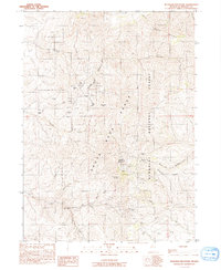
1991 Map of Buckskin Mountain
USGS Topo · Published 1991About this map
The Santa Rosa Range dominates this landscape in the northern high desert, where steep peaks and deep drainages define the character of the Humboldt National Forest. By the late 20th century, the legacy of early mining is clearly etched into the terrain of Buckskin Mountain, with prominent workings including the Buckskin National Mine and the National Mine situated near National Gulch. The arrangement of these claims near Charleston Hill and White Hill indicates a concentrated period of mineral exploration in this remote portion of Humboldt County.
Find a feature on this map
29 named features on this map. Tap any name to fly to it.
Don’t see what you’re looking for? This feature index may not catch every label — zoom into the map to look around manually.
Map Details
Editions of this 1991 Buckskin Mountain Map
This is the sole edition of this map. No revisions or reprints were ever made.
Other maps of this area

1882 · Paradise
USGS Topo · 1:250,000

1893 · Paradise
USGS Topo · 1:250,000

1955 · McDermitt
USGS Topo · 1:250,000

1959 · McDermitt
USGS Topo · 1:250,000

1959 · McDermitt
USGS Topo · 1:62,500

1959 · Hinkey Summit
USGS Topo · 1:62,500

1980 · Odell Mountain
USGS Topo · 1:24,000

1980 · Black Ridge
USGS Topo · 1:24,000
1980 · Holloway Meadows
USGS Topo · 1:24,000

1985 · Quinn River Valley
USGS Topo · 1:100,000