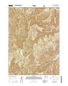
2014 Map of Buckskin Peak
USGS Topo · Published 2014About this map
Buckskin Peak and the high ridges of the Siskiyou National Forest dominate this terrain along the border of Josephine and Curry counties. This 2014 survey documents a complex network of drainages that feed the region's major waterways, including the headwaters of Baldface Cr and the winding course of the W Fork Illinois River. The landscape is defined by its topographic extremes, from the heights of Oregon Mtn and Our Mtn to the secluded waters of Baldface Lake. Small clearings and water sources like Frantz Meadow, Cedar Springs, and Mud Spring provide specific points of reference within the extensive forest boundaries. The map's detailed hydrography reveals the intricate forks of Whiskey Cr and the N Fork Rough and Ready Cr, illustrating the watershed patterns that have shaped this portion of the Klamath Mountains.
Find a feature on this map
26 named features on this map. Tap any name to fly to it.
Don’t see what you’re looking for? This feature index may not catch every label — zoom into the map to look around manually.
Map Details
Editions of this 2014 Buckskin Peak Map
This is the sole edition of this map. No revisions or reprints were ever made.
Other maps of this area

1917 · Kerby
USGS Topo · 1:125,000

1918 · Kerby
USGS Topo · 1:125,000

1922 · Preston Peak
USGS Topo · 1:125,000

1945 · Kerby
USGS Topo · 1:125,000

1945 · Gasquet
USGS Topo · 1:62,500

1948 · Weed
USGS Topo · 1:250,000

1950 · Weed
USGS Topo · 1:250,000

1951 · Gasquet
USGS Topo · 1:62,500

1954 · Cave Junction
USGS Topo · 1:62,500

1954 · Chetco Peak
USGS Topo · 1:62,500