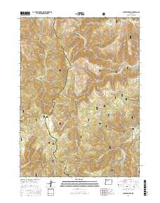
2017 Map of Buckskin Peak
USGS Topo · Published 2017About this map
Buckskin Peak stands as the central landmark of this high-elevation terrain within the Siskiyou National Forest along the border of Josephine and Curry counties. This 2017 survey details a landscape defined by its complex drainage systems, including the headwaters of the N Fork Rough and Ready Cr and the S Fork Rough and Ready Cr. The map reveals a network of Forest Service infrastructure, such as Nat For Dev Rd 112 and Nat For Dev Rd 4402, which navigate the steep ridges between peaks like Oregon Mtn and Our Mtn. Small, isolated water features such as Baldface Lake, Cedar Springs, and Mud Spring provide critical points of interest for those studying the hydrology and recreational geography of this wilderness area. The presence of Frantz Meadow and the winding course of the W Fork Illinois River in the southeast corner further illustrate the varied mountain ecology preserved on this quadrangle.
Find a feature on this map
35 named features on this map. Tap any name to fly to it.
Don’t see what you’re looking for? This feature index may not catch every label — zoom into the map to look around manually.
Map Details
Editions of this 2017 Buckskin Peak Map
This is the sole edition of this map. No revisions or reprints were ever made.
Other maps of this area

1917 · Kerby
USGS Topo · 1:125,000

1918 · Kerby
USGS Topo · 1:125,000

1922 · Preston Peak
USGS Topo · 1:125,000

1945 · Kerby
USGS Topo · 1:125,000

1945 · Gasquet
USGS Topo · 1:62,500

1948 · Weed
USGS Topo · 1:250,000

1950 · Weed
USGS Topo · 1:250,000

1951 · Gasquet
USGS Topo · 1:62,500

1954 · Cave Junction
USGS Topo · 1:62,500

1954 · Chetco Peak
USGS Topo · 1:62,500