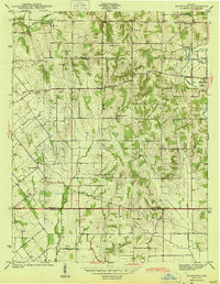
1957 Map of Bucktown
USGS Topo · Published 1958About this map
Bucktown and Pleasantville anchor this 1940s survey of the rural landscape along the border of Sullivan and Knox Counties. The area is defined by a dense network of country churches and family cemeteries that speak to the deep-rooted settlement patterns of Haddon and Jefferson townships. Landmarks such as Mt Zion Ch, Mt Moriah Ch, and the Bethlehem Ch are interspersed with resting places like Skidmore Cem and Land Cem.
Find a feature on this map
31 named features on this map. Tap any name to fly to it.
Don’t see what you’re looking for? This feature index may not catch every label — zoom into the map to look around manually.
Map Details
Editions of this 1957 Bucktown Map
4 editions found
Other maps of this area

1940 · Linton
USGS Topo · 1:24,000

1943 · Carlisle
USGS Topo · 1:24,000

1943 · Oaktown
USGS Topo · 1:24,000

1943 · Sandborn
USGS Topo · 1:24,000

1943 · Bicknell
USGS Topo · 1:24,000

1943 · Plainville
USGS Topo · 1:24,000

1943 · Sullivan
USGS Topo · 1:24,000

1943 · Dugger
USGS Topo · 1:24,000

1944 · Bucktown
USGS Topo · 1:24,000

1947 · Linton
USGS Topo · 1:24,000