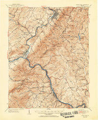
1952 Map of Buena Vista
USGS Topo · Published 1952About this map
The James River and Maury River converge at Glasgow in this mid-century look at the Blue Ridge foothills. The landscape is defined by the heavy infrastructure of the Norfolk and Western Railway and the Chesapeake and Ohio Railway, which follow the riverbanks past industrial sites like Big Island and Holcomb Rock. To the north, the manufacturing center of Buena Vista serves as a primary hub, while the surrounding countryside is dotted with small rural communities like Mechanicsville and Buffalo Forge.
Find a feature on this map
142 named features on this map. Tap any name to fly to it.
Don’t see what you’re looking for? This feature index may not catch every label — zoom into the map to look around manually.
Map Details
Editions of this 1952 Buena Vista Map
2 editions found
Other maps of this area

1890 · Roanoke
USGS Topo · 1:125,000

1891 · Roanoke
USGS Topo · 1:125,000

1892 · Lynchburg
USGS Topo · 1:125,000

1894 · Natural Bridge
USGS Topo · 1:125,000

1894 · Lexington
USGS Topo · 1:125,000

1894 · Natural Bridge
USGS Topo · 1:62,500

1907 · Natural Bridge Special
USGS Topo · 1:62,500

1932 · Lexington
USGS Topo · 1:48,000

1935 · Buena Vista
USGS Topo · 1:48,000

1935 · Amherst
USGS Topo · 1:48,000