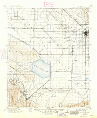
1912 Map of Buena Vista Lake
USGS Topo · Published 1947About this map
Buena Vista Lake and the Kern Lake Bed dominate the southern San Joaquin Valley in this early 20th-century landscape, a region defined by an intricate network of irrigation and transport. The city of Bakersfield serves as the eastern anchor, where the Kern River fans out into numerous man-made channels like the Lerdo Canal and Beardsley Canal. This period marks the height of the oil boom and agricultural expansion, evidenced by the clustered settlements of Monarch and Maricopa in the Sunset Valley, and the rural schools like Rio Bravo School and Fruitvale School dotting the plains.
Find a feature on this map
74 named features on this map. Tap any name to fly to it.
Don’t see what you’re looking for? This feature index may not catch every label — zoom into the map to look around manually.
Map Details
Editions of this 1912 Buena Vista Lake Map
4 editions found
Other maps of this area

1902 · Santa Ynez
USGS Topo · 1:125,000

1903 · Mt. Pinos
USGS Topo · 1:125,000

1903 · Tejon
USGS Topo · 1:125,000

1905 · Santa Ynez
USGS Topo · 1:125,000

1906 · Bakersfield
USGS Topo · 1:62,500

1910 · Buena Vista Lake
USGS Topo · 1:125,000

1912 · McKittrick
USGS Topo · 1:125,000

1912 · Buena Vista Lake
USGS Topo · 1:125,000

1914 · Caliente
USGS Topo · 1:125,000

1914 · Lost Hills
USGS Topo · 1:125,000