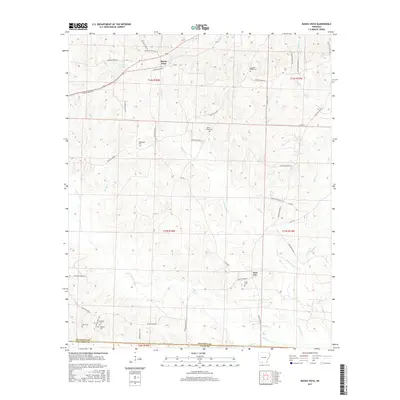
2017 Map of Buena Vista
USGS Topo · Published 2017About this map
Buena Vista sits at the junction of several county routes in this portion of south-central Arkansas, surrounded by a landscape defined by its many creek branches and cemeteries. The settlement of Pace City is located to the southeast, positioned near the waters of Gum Cr. The terrain is characterized by a dense network of watercourses, including Holcomb Cr, Beech Cr, and Cypress Cr, all feeding toward the larger Smackover Cr at the southern boundary. For genealogists and local historians, this map is a significant record of family and community burial sites. Numerous small cemeteries are scattered throughout the quadrangle, such as Whitefield Cem, Good Hope Cem, Haltom Cem, and Tate Cem. The presence of Lake Landers in the northwest and various small crossings like Reeds Br and Howell Br illustrate the hydraulic character of the Ouachita County uplands.
Find a feature on this map
56 named features on this map. Tap any name to fly to it.
Don’t see what you’re looking for? This feature index may not catch every label — zoom into the map to look around manually.
Map Details
Editions of this 2017 Buena Vista Map
This is the sole edition of this map. No revisions or reprints were ever made.
Other maps of this area

1901 · Gurdon
USGS Topo · 1:125,000

1903 · Camden
USGS Topo · 1:125,000

1951 · Camden
USGS Topo · 1:24,000

1953 · El Dorado
USGS Topo · 1:250,000

1957 · El Dorado
USGS Topo · 1:250,000

1958 · El Dorado
USGS Topo · 1:250,000

1960 · El Dorado
USGS Topo · 1:250,000

1962 · Lisbon
USGS Topo · 1:24,000

1962 · Louann
USGS Topo · 1:24,000

1962 · Buena Vista
USGS Topo · 1:24,000