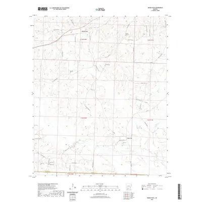
2020 Map of Buena Vista
USGS Topo · Published 2020About this map
Buena Vista sits at the heart of this landscape, where the rolling timberlands of southern Arkansas are marked by a dense network of county roads and family-named cemeteries. The terrain is defined by the drainages of Smackover Cr and its tributaries, including Gum Cr and Mill Cr, which carve through the countryside. For genealogists and local historians, the map provides an exceptional record of family burial sites, from Whitefield Cem and Pleasant Ridge Cem to the clustered Haltom Cem and Watkins Cem in the southwestern corner. The presence of Lake Landers near the upper boundary and the winding paths of Jerdon Cr and Beech Cr further illustrate the hydrology of Ouachita County. This survey reflects the modern rural character of the region, where legacy land divisions like t14s r18w still govern the layout of properties and roads.
Find a feature on this map
57 named features on this map. Tap any name to fly to it.
Don’t see what you’re looking for? This feature index may not catch every label — zoom into the map to look around manually.
Map Details
Editions of this 2020 Buena Vista Map
This is the sole edition of this map. No revisions or reprints were ever made.
Other maps of this area

1901 · Gurdon
USGS Topo · 1:125,000

1903 · Camden
USGS Topo · 1:125,000

1951 · Camden
USGS Topo · 1:24,000

1953 · El Dorado
USGS Topo · 1:250,000

1957 · El Dorado
USGS Topo · 1:250,000

1958 · El Dorado
USGS Topo · 1:250,000

1960 · El Dorado
USGS Topo · 1:250,000

1962 · Lisbon
USGS Topo · 1:24,000

1962 · Louann
USGS Topo · 1:24,000

1962 · Buena Vista
USGS Topo · 1:24,000