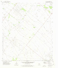
1972 Map of Buena Vista
USGS Topo · Published 1975About this map
Abell Oil and Gas Field and the surrounding energy landscape dominate this Pecos County terrain in the early 1970s. The region is defined by an extensive network of drill holes, oil wells, and flowing wells, illustrating the intense petroleum extraction of the era. Settlements such as Abell City and Buena Vista serve as small anchors within a vast grid of industrial infrastructure, where pipelines and unimproved roads connect dispersed production sites across the arid landscape.
Find a feature on this map
12 named features on this map. Tap any name to fly to it.
Don’t see what you’re looking for? This feature index may not catch every label — zoom into the map to look around manually.
Map Details
Editions of this 1972 Buena Vista Map
This is the sole edition of this map. No revisions or reprints were ever made.
Other maps of this area

1954 · Pecos
USGS Topo · 1:250,000

1957 · Pecos
USGS Topo · 1:250,000

1969 · Grandfalls
USGS Topo · 1:24,000
1972 · Buena Vista NE
USGS Topo · 1:24,000
1972 · Buena Vista SW
USGS Topo · 1:24,000
1972 · Owego
USGS Topo · 1:24,000

1974 · Juan Cordona Lake
USGS Topo · 1:24,000
1974 · Diamond Y Spring NE
USGS Topo · 1:24,000
1974 · Diamond Y Spring SE
USGS Topo · 1:24,000
1974 · Imperial
USGS Topo · 1:24,000