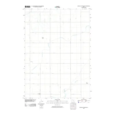
2010 Map of Buffalo Center SW
USGS Topo · Published 2010About this map
Little Buffalo Creek and Buffalo Creek meander through this agricultural landscape in Kossuth County, defining the drainage patterns of the rural Grant Township area. The terrain is structured by a precise grid of gravel and paved roads, reflecting the systematic land division characteristic of northern Iowa. Institutional landmarks provide historical anchor points for the surrounding farming community, including the Immanuel Lutheran Church and its adjacent Immanuel Lutheran Church Cemetery in the southwest corner. In the eastern portion of the quadrangle, the Grant Township Cemetery sits quietly among the fields. Aviation infrastructure is represented by the Buffalo Center Airport, while the northern reaches of the map show early water management efforts through Drainage Ditch Number 1. This survey captures the steady, enduring layout of rural Iowa as it appeared in the early 21st century.
Find a feature on this map
22 named features on this map. Tap any name to fly to it.
Don’t see what you’re looking for? This feature index may not catch every label — zoom into the map to look around manually.
Map Details
Editions of this 2010 Buffalo Center SW Map
This is the sole edition of this map. No revisions or reprints were ever made.
Other maps of this area

1954 · Fairmont
USGS Topo · 1:250,000

1954 · Mason City
USGS Topo · 1:250,000

1957 · Mason City
USGS Topo · 1:250,000

1958 · Mason City
USGS Topo · 1:250,000

1958 · Fairmont
USGS Topo · 1:250,000

1972 · German Valley
USGS Topo · 1:24,000

1972 · Buffalo Center
USGS Topo · 1:24,000

1972 · Buffalo Center SW
USGS Topo · 1:24,000

1972 · Buffalo Center NE
USGS Topo · 1:24,000

1972 · Titonka
USGS Topo · 1:24,000