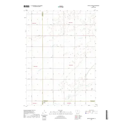
2018 Map of Buffalo Center SW
USGS Topo · Published 2018About this map
The agricultural plains of Kossuth County and its borders with Winnebago and Hancock counties are defined by a meticulous grid of rural roads and the slow-moving waters of the Buffalo Creek watershed. This 2018 survey reveals a landscape dedicated to large-scale farming, where the natural hydrology has been heavily managed, evidenced by features like Drainage Ditch Number 48 which channelizes water through the tillable acres. Genealogists will find local heritage preserved at the Grant Township Cemetery and the Immanuel Lutheran Church Cemetery near the southern boundary. The map illustrates how secondary routes like County Road A36 and County Highway B connect isolated farmsteads across the township lines of T98N R27W and T99N R26W, maintaining a settlement pattern that has persisted for generations in northern Iowa.
Find a feature on this map
38 named features on this map. Tap any name to fly to it.
Don’t see what you’re looking for? This feature index may not catch every label — zoom into the map to look around manually.
Map Details
Editions of this 2018 Buffalo Center SW Map
This is the sole edition of this map. No revisions or reprints were ever made.
Other maps of this area

1954 · Fairmont
USGS Topo · 1:250,000

1954 · Mason City
USGS Topo · 1:250,000

1957 · Mason City
USGS Topo · 1:250,000

1958 · Mason City
USGS Topo · 1:250,000

1958 · Fairmont
USGS Topo · 1:250,000

1972 · German Valley
USGS Topo · 1:24,000

1972 · Buffalo Center
USGS Topo · 1:24,000

1972 · Buffalo Center SW
USGS Topo · 1:24,000

1972 · Buffalo Center NE
USGS Topo · 1:24,000

1972 · Titonka
USGS Topo · 1:24,000