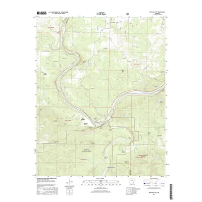
2017 Map of Buffalo City
USGS Topo · Published 2017About this map
The confluence of the Buffalo River and the White River marks a primary focal point of this Arkansas landscape, where the Buffalo National River meets the larger waterway near Buffalo City. This area is characterized by dramatic river bends and significant elevation changes, noted by landmarks like Stair Bluff and Hudsons Bend. The settlement pattern follows the meandering river valleys and ridge lines, with small communities such as Old Buffalo, Buford, and Cartney connected by a network of rural routes like Gilbert Rd and Riverside Dr. Local history is preserved in sites like Haskell Cem and Nelson Cem, which sit above the river plains on higher ground. South of the rivers, the terrain rises into the Ozark National Forest, where the landscape is defined by deep hollows and named peaks including Hathaway Mtn and Prince Fred Knob.
Find a feature on this map
117 named features on this map. Tap any name to fly to it.
Don’t see what you’re looking for? This feature index may not catch every label — zoom into the map to look around manually.
Map Details
Editions of this 2017 Buffalo City Map
This is the sole edition of this map. No revisions or reprints were ever made.
Other maps of this area

1890 · Mountain Home
USGS Topo · 1:125,000

1891 · Mountain Home
USGS Topo · 1:125,000

1893 · Yellville
USGS Topo · 1:125,000

1894 · Mountain Home
USGS Topo · 1:125,000

1903 · Yellville
USGS Topo · 1:125,000

1905 · Yellville
USGS Topo · 1:125,000

1929 · Yellville
USGS Topo · 1:125,000

1945 · Harrison
USGS Topo · 1:250,000

1949 · Harrison
USGS Topo · 1:250,000

1954 · Harrison
USGS Topo · 1:250,000