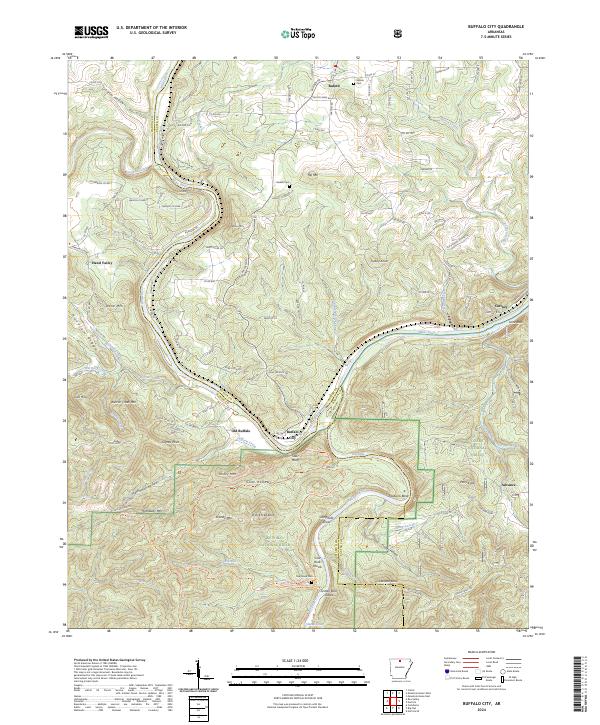
2024 Map of Buffalo City
USGS Topo · Published 2024About this map
Buffalo City and the neighboring settlement of Old Buffalo sit at the confluence of the White River and the Buffalo River, a landscape defined by the convergence of these major Ozark waterways along the Marion Co and Baxter Co line. The terrain is marked by steep elevation changes, with Stair Bluff and Turkey Mountain overlooking the river bends, while protected areas like the Buffalo National River Wilderness and Leatherwood Wilderness preserve the natural character of the riverbanks and hollows. Local history is anchored by rural centers such as Buford and Cartney, and family-named landmarks like Nelson Cemetery and Haskell Cemetery. The map illustrates a network of county roads, such as Buford Spur Rd and Riverside Dr, which navigate the ridges and hollows that divide the river valleys from upland reaches like Hoodlum Ridge and Hip Mountain.
Find a feature on this map
126 named features on this map. Tap any name to fly to it.
Don’t see what you’re looking for? This feature index may not catch every label — zoom into the map to look around manually.
Map Details
Editions of this 2024 Buffalo City Map
This is the sole edition of this map. No revisions or reprints were ever made.
Other maps of this area

1890 · Mountain Home
USGS Topo · 1:125,000

1891 · Mountain Home
USGS Topo · 1:125,000

1893 · Yellville
USGS Topo · 1:125,000

1894 · Mountain Home
USGS Topo · 1:125,000

1903 · Yellville
USGS Topo · 1:125,000

1905 · Yellville
USGS Topo · 1:125,000

1929 · Yellville
USGS Topo · 1:125,000

1945 · Harrison
USGS Topo · 1:250,000

1949 · Harrison
USGS Topo · 1:250,000

1954 · Harrison
USGS Topo · 1:250,000