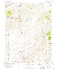
1967 Map of Buffalo Creek
USGS Topo · Published 1968About this map
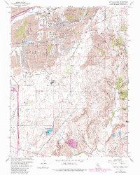
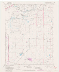
Dredge tailings dominate the northern landscape of this Sacramento County region, a physical legacy of large-scale gold mining operations that reshaped the terrain near Buffalo Creek. The map documents a period of significant military and industrial presence, anchored by the eastern edge of Mather Air Force Base and a dedicated U. S. Military Reservation. Infrastructure is highly developed to support these activities, featuring the Southern Pacific Railroad, an aqueduct, and various water tanks. To the south, the landscape transitions into ranching and early suburban footprints like Frye, where water management becomes central through Blodgett Reservoir and a network of creeks including Deer Creek and Laguna Creek. The inclusion of the Carson Creek High Sch and multiple sewage disposal facilities indicates the growing municipal needs of the late 1960s as development moved into the historic Rio de los Americanos land grant.
Find a feature on this map
36 named features on this map. Tap any name to fly to it.
Don’t see what you’re looking for? This feature index may not catch every label — zoom into the map to look around manually.
Map Details
Editions of this 1967 Buffalo Creek Map
6 editions found
Other maps of this area

1891 · Sacramento
USGS Topo · 1:125,000

1892 · Sacramento
USGS Topo · 1:125,000

1893 · Sacramento
USGS Topo · 1:125,000

1894 · Lodi
USGS Topo · 1:125,000

1902 · Fairoaks
USGS Topo · 1:62,500

1908 · Buffalo Creek
USGS Topo · 1:31,680

1909 · Elk Grove
USGS Topo · 1:31,680

1909 · Carbondale
USGS Topo · 1:31,680

1909 · Cosumnes
USGS Topo · 1:31,680

1911 · Mills
USGS Topo · 1:31,680